Civil War
Hover over image to see caption. Click for larger image and a manual slide show with captions. Keyboard arrows can be used
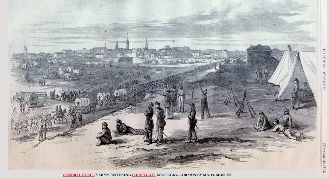
"I hope to have God on my side but I must have Kentucky." - Abraham Lincoln, early in the Civil War.
150 years ago there were 11 forts and 2 batteries protecting the southern flank of Louisville in the Civil War. The typically fort held a minimum of 50 artillerists and 200 infantrymen, with four to six cannon. The forts' lengths were between 550 and 700 feet, with walls fifteen to thirty feet thick, and six to eight feet high. 200 rounds for each gun were available in the forts.
Louisville was never endangered, so the guns never fired, except for salutes. Confederate forces had reached within two miles of the city but were not numerous enough to invade it. On September 30, 1862, Confederate and Union pickets fought at Gilman's Point in St. Matthews and the Confederates were pushed back through Middletown to Floyd's Fork. - Wikipedia
Below are 5 maps showing the forts. Two maps are of the entire area and three others are enlarged sections - West, East, and Northeast.
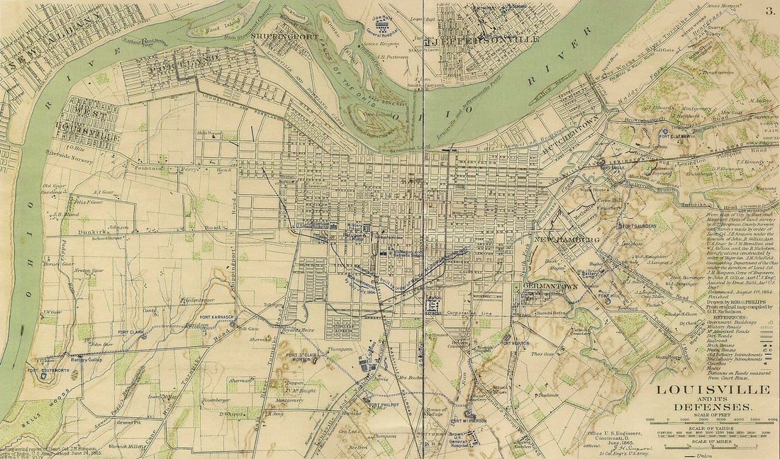
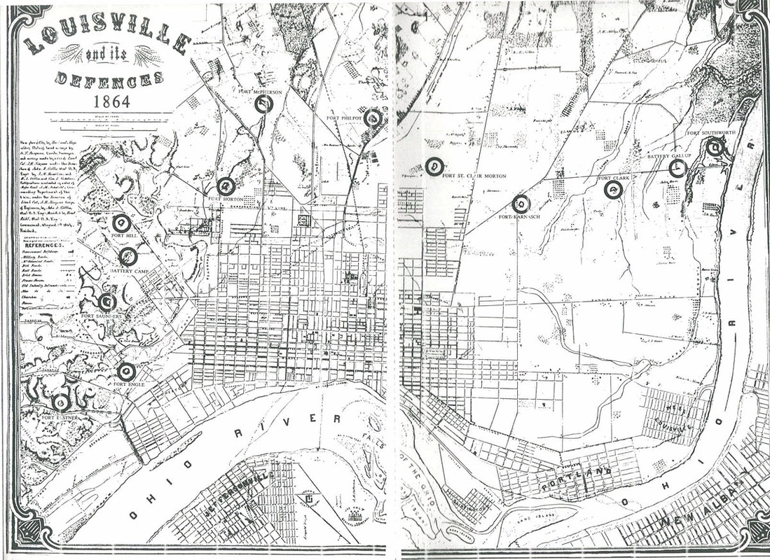
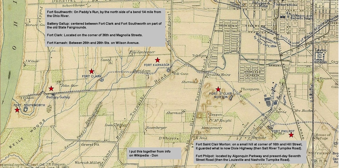


Forts & Batteries, West
1 Fort Southworth: On Paddy's Run, by the north side of a bend 1/4 mile from the Ohio River. It was named for A. J. Southworth, who died in Atlanta, Georgia, in August 1864. It was the westernmost of the fortifications and covered 19,000 square feet (1,800 m2) in total. Its construction began on August 1, 1864 and was paid for both by Louisville and by the federal government.
2 Battery Gallup: centered between Fort Clark and Fort Southworth on part of the old State Fairgrounds, it was named for A.G. Gallup of the 13th Kentucky Infantry who died in September 1864 in Georgia.
3 Fort Clark: Located on the corner of 36th and Magnolia Streets. It was named for Lt. Col. Merwin Clark of the 183rd Ohio Infantry who died at the Battle of Franklin in November 1864.
4 Fort Karnash: Between 26th and 28th Sts. on Wilson Avenue. It was named for Julius E. Karnash, a Second Lieutenant of the 35th Missouri Infantry who died in Atlanta, Georgia in August 1864.
5 Fort Saint Clair Morton: on a small hill at corner of 16th and Hill Street, it guarded what is now Dixie Highway (then Salt River Turnpike Road). Named for Major James St. Clair Morton of the Corps of Engineers, who died in the Battle of Petersburg in June 1864.
6 Fort Philpot: located by Algonquin Parkway and present-day Seventh Street Road (then the Louisville and Nashville Turnpike Road). It was named for J. D. Philpot, a captain for the 103rd Ohio Infantry who died in the Battle of Resaca in May 1864.
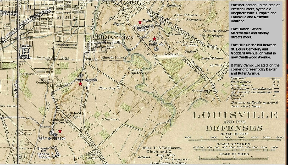
Forts and Batteries, East
7 Fort McPherson: in the area of Preston Street, by the old Shepherdsville Turnpike and Louisville and Nashville Railroad, south of the old city limits. It was named for the Major General, James B. McPherson, who died in Atlanta, Georgia in July 1864. It was the largest of fortifications for Louisville. It was also the first to be built. It typically held 100 artillerists and 500 infantry, but could hold upwards to a thousand soldiers. Its Parrott rifle, actually an artillery cannon, could shoot an 100-pounder shell five miles (8 km) away. It was complemented with ten additional artillery pieces. It also featured a caponier battery, built in the October 1864.
8 Fort Horton: Where Merriwether and Shelby Streets meet. It was named for M.C. Horton, a captain of the 104th Ohio Infantry who died in Georgia on May 1864.
9 Fort Hill: On the hill between St. Louis Cemetery and Goddard Avenue, on what is now Castlewood Avenue. It was named for George W. Hill, a captain in the 12th Kentucky Infantry who died in Atlanta, Georgia in August 1864.
10 Battery Camp: Located on the corner of present-day Baxter and Rufer Avenue.
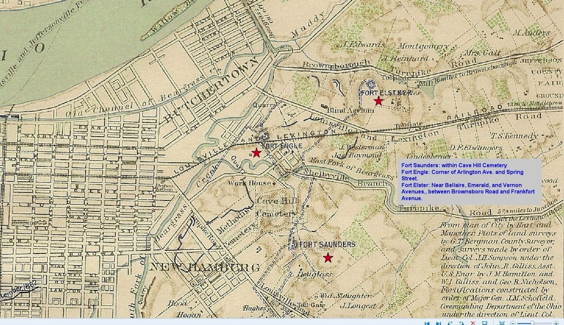
Forts & Batteries, Northeast
11 Fort Saunders: within Cave Hill Cemetery, named after E.D. Saunders of the A.A.G. Volunteers, who died in Georgia in June 1864.
12 Fort Engle: Corner of Arlington Ave. and Spring Street. It was named for Captain Archibald H. Engle of the 13th U.S. Infantry, who died in Georgia in May 1864.
13 Fort Elster: Near Bellaire, Emerald, and Vernon Avenues., between Brownsboro Road and Frankfort Avenue. It was named for George R. Elstner, a Lieutenant Colonel of the 50th Ohio Infantry who died in Georgia in August 1864.
1 Fort Southworth: On Paddy's Run, by the north side of a bend 1/4 mile from the Ohio River. It was named for A. J. Southworth, who died in Atlanta, Georgia, in August 1864. It was the westernmost of the fortifications and covered 19,000 square feet (1,800 m2) in total. Its construction began on August 1, 1864 and was paid for both by Louisville and by the federal government.
2 Battery Gallup: centered between Fort Clark and Fort Southworth on part of the old State Fairgrounds, it was named for A.G. Gallup of the 13th Kentucky Infantry who died in September 1864 in Georgia.
3 Fort Clark: Located on the corner of 36th and Magnolia Streets. It was named for Lt. Col. Merwin Clark of the 183rd Ohio Infantry who died at the Battle of Franklin in November 1864.
4 Fort Karnash: Between 26th and 28th Sts. on Wilson Avenue. It was named for Julius E. Karnash, a Second Lieutenant of the 35th Missouri Infantry who died in Atlanta, Georgia in August 1864.
5 Fort Saint Clair Morton: on a small hill at corner of 16th and Hill Street, it guarded what is now Dixie Highway (then Salt River Turnpike Road). Named for Major James St. Clair Morton of the Corps of Engineers, who died in the Battle of Petersburg in June 1864.
6 Fort Philpot: located by Algonquin Parkway and present-day Seventh Street Road (then the Louisville and Nashville Turnpike Road). It was named for J. D. Philpot, a captain for the 103rd Ohio Infantry who died in the Battle of Resaca in May 1864.
Forts and Batteries, East
7 Fort McPherson: in the area of Preston Street, by the old Shepherdsville Turnpike and Louisville and Nashville Railroad, south of the old city limits. It was named for the Major General, James B. McPherson, who died in Atlanta, Georgia in July 1864. It was the largest of fortifications for Louisville. It was also the first to be built. It typically held 100 artillerists and 500 infantry, but could hold upwards to a thousand soldiers. Its Parrott rifle, actually an artillery cannon, could shoot an 100-pounder shell five miles (8 km) away. It was complemented with ten additional artillery pieces. It also featured a caponier battery, built in the October 1864.
8 Fort Horton: Where Merriwether and Shelby Streets meet. It was named for M.C. Horton, a captain of the 104th Ohio Infantry who died in Georgia on May 1864.
9 Fort Hill: On the hill between St. Louis Cemetery and Goddard Avenue, on what is now Castlewood Avenue. It was named for George W. Hill, a captain in the 12th Kentucky Infantry who died in Atlanta, Georgia in August 1864.
10 Battery Camp: Located on the corner of present-day Baxter and Rufer Avenue.
Forts & Batteries, Northeast
11 Fort Saunders: within Cave Hill Cemetery, named after E.D. Saunders of the A.A.G. Volunteers, who died in Georgia in June 1864.
12 Fort Engle: Corner of Arlington Ave. and Spring Street. It was named for Captain Archibald H. Engle of the 13th U.S. Infantry, who died in Georgia in May 1864.
13 Fort Elster: Near Bellaire, Emerald, and Vernon Avenues., between Brownsboro Road and Frankfort Avenue. It was named for George R. Elstner, a Lieutenant Colonel of the 50th Ohio Infantry who died in Georgia in August 1864.
Camp Boone
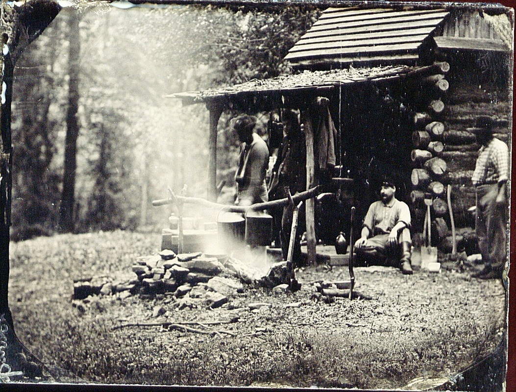
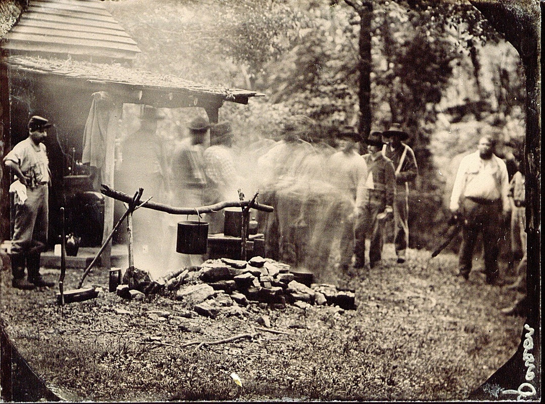
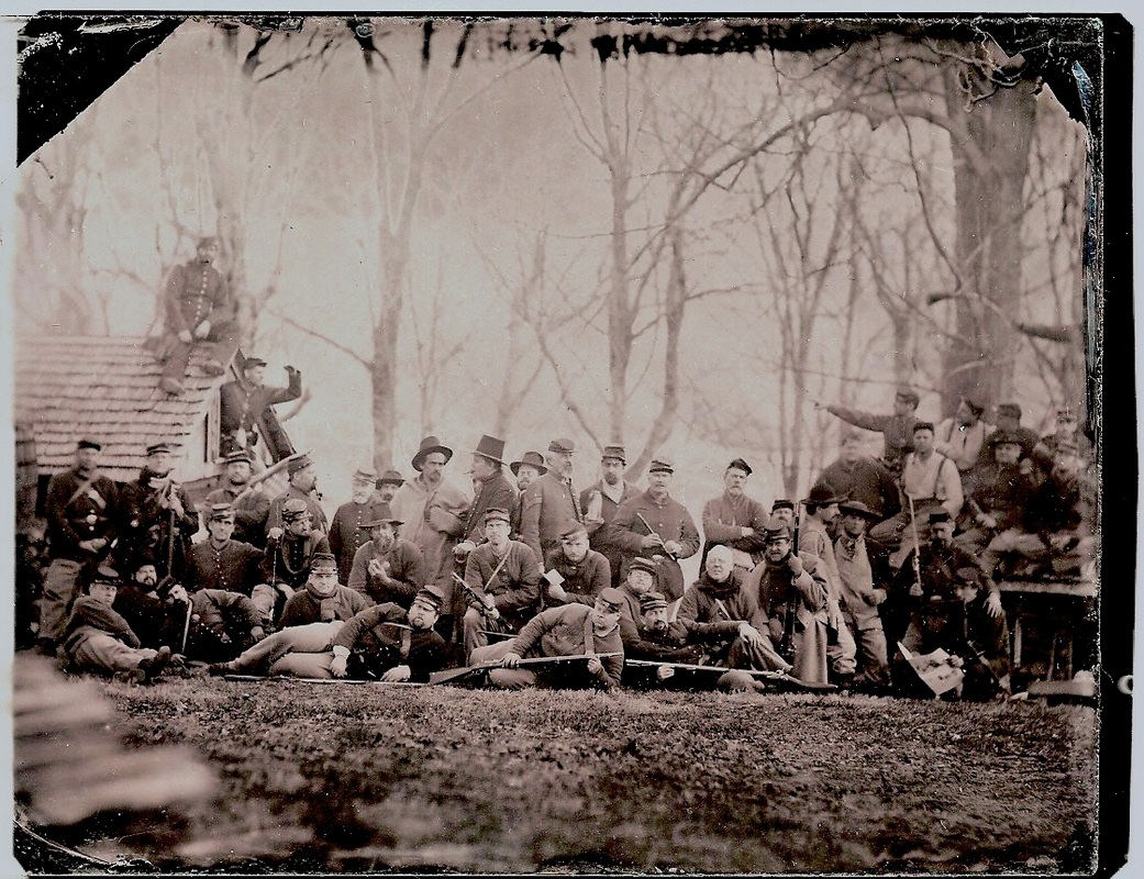
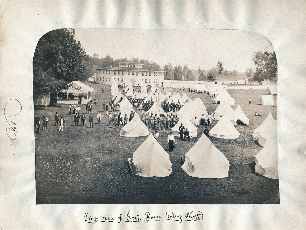
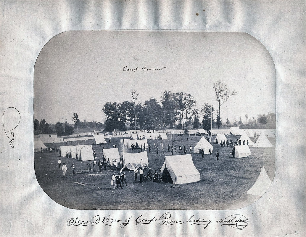
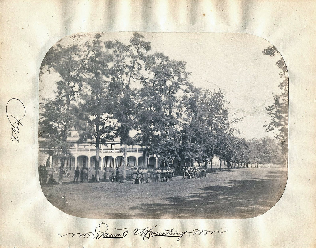
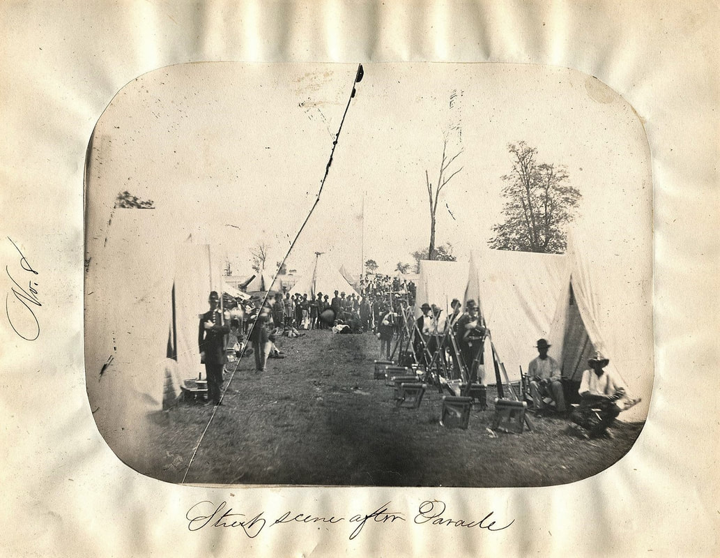
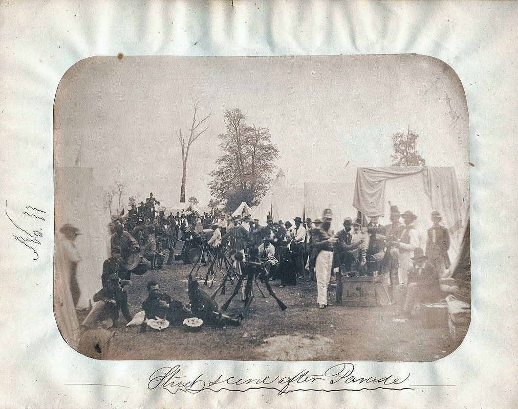
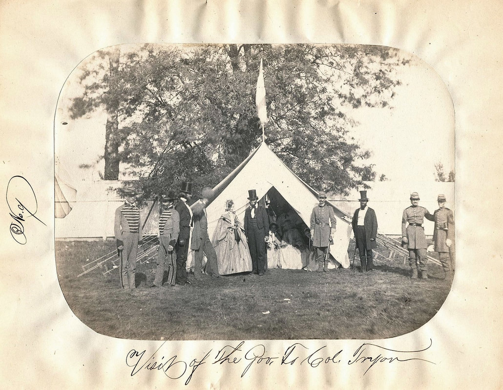
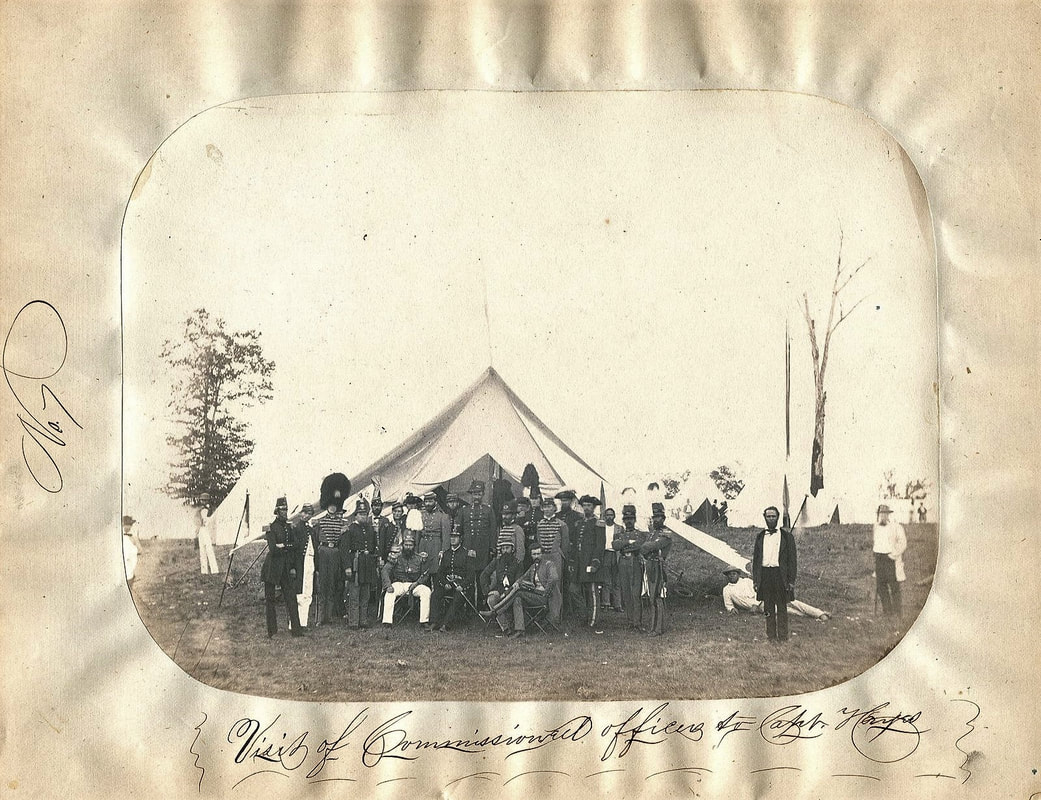
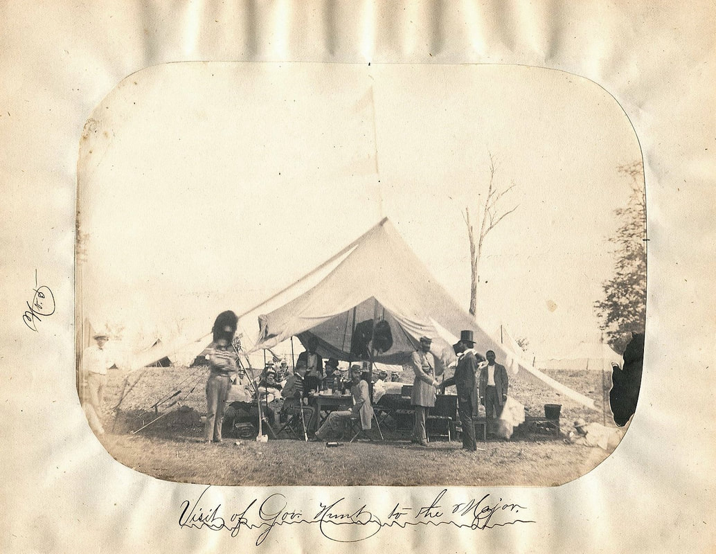
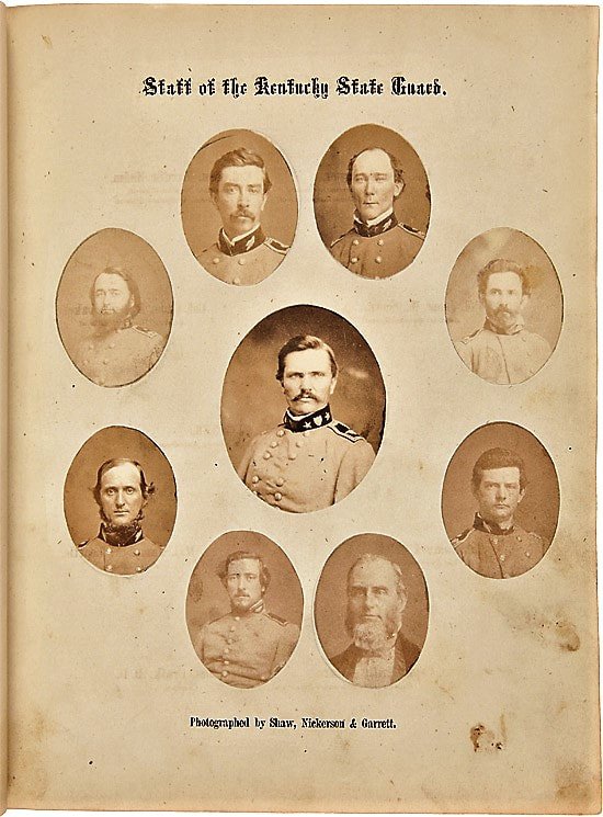
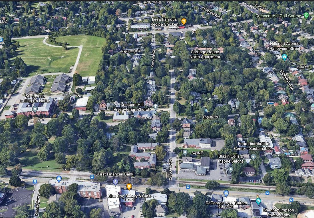
An exceedingly rare and early photographic work of eleven images of 1860 State Guard Encampment at Camp Boone in the lead-up to the Civil War. It was located at the Louisville Fairgrounds in what is now the Crescent Hill neighborhood.
Today's Crescent Avenue off Frankfort Avenue was the grand "promenade" entryway into the Fair Grounds — a 38-acre site outfitted with agricultural and machinery exhibition halls, a trotting track and amphitheater for livestock shows accommodating 10,000 — that existed from 1853 to 1873.
It also once was occupied by Union troops, before being auctioned off in the aftermath of the Civil War and turned into the Fair View subdivision. Fourth of July events, carnivals and other gatherings also were held there.
-----------------------------------------
On March 5, 1860, foreseeing the coming of an armed conflict, the Kentucky State Legislature organized the Kentucky State Guard. By early spring the officers had received their commissions, with Simon Bolivar Buckner named inspector-general with the rank of major general. On Aug. 23, 1860 the Kentucky State Guard assembled for the first time on the grounds of the South-Western Agricultural Association in Louisville, naming their camp for famed Kentuckian Daniel Boone.
.
The state of Kentucky declared neutrality during the American Civil War 1861-1865. It was not long, however, before the state legislature moved to side with the Union As the head of the state's military forces Major-General Simon Bolivar Buckner attempted to preserve the guards precarious neutrality but in July 1861 the Unionist-controlled military board of the state ordered the State Guard, which they considered pro-secessionist, to turn in its arms.
As a result, most of the Kentucky State Guard troops joined the Confederate Army during the American Civil War. This included Buckner, as well as Captain John Hunt Morgan, the infamous leader of the Morgan Raiders. Interestingly, one image within the work would seem to depict Morgan’s men, as one of the crates in the foreground is labelled “Lex. Rifles”, after the name of Morgan’s company (the Lexington Rifles). Thus the present work, depicting the Kentucky State Guard in August of 1860, inadvertently captures the images of many soon-to-be soldiers in the Confederate Army.


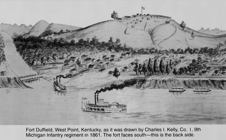
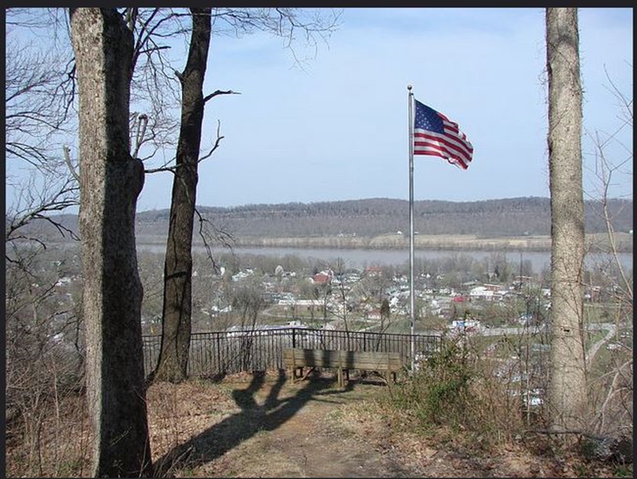
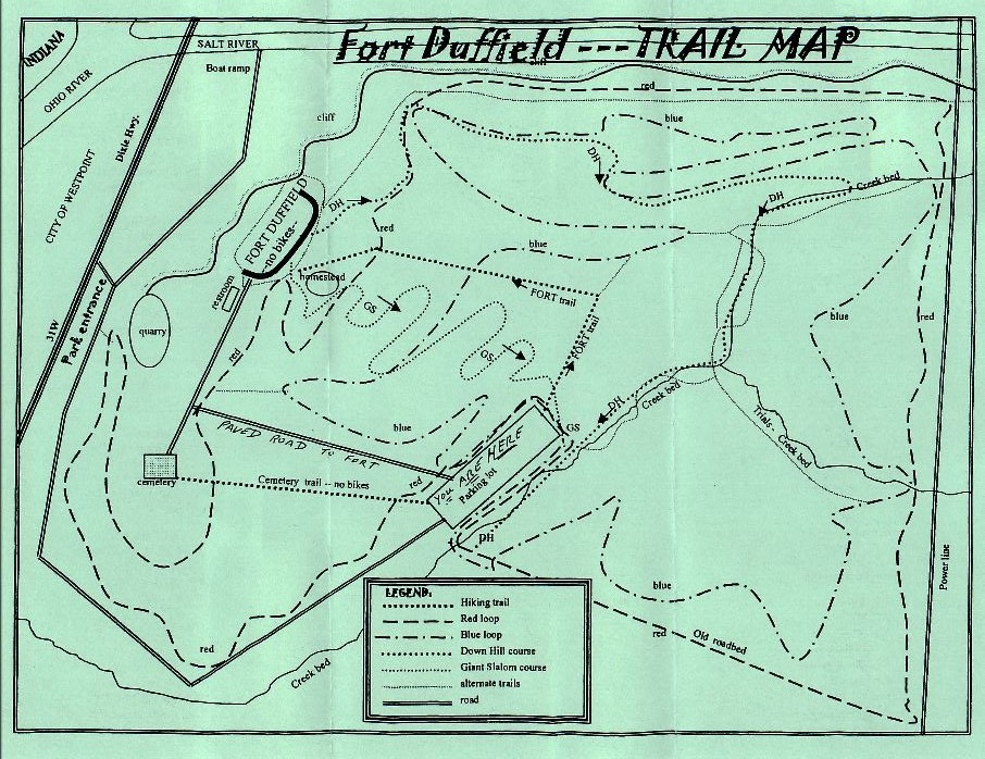
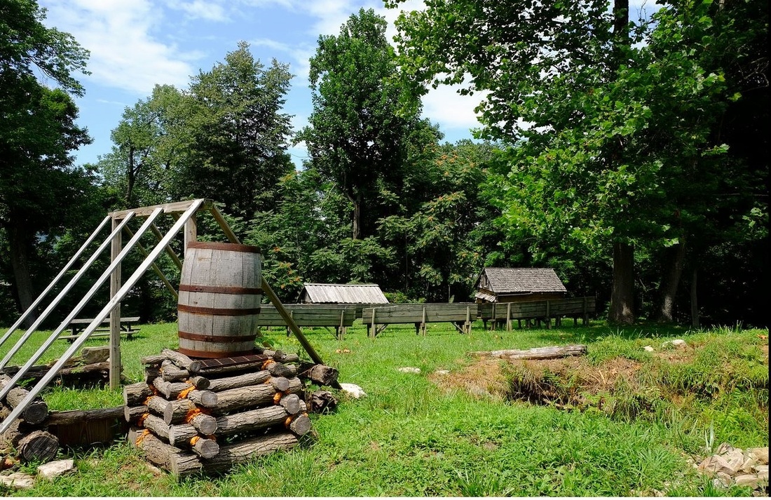
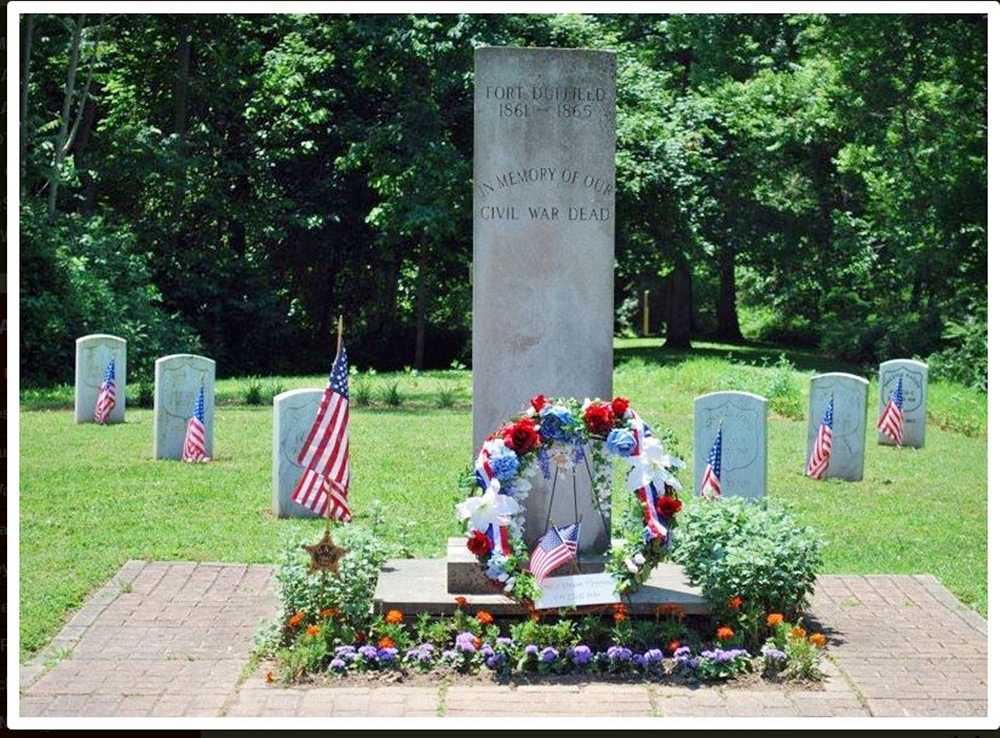
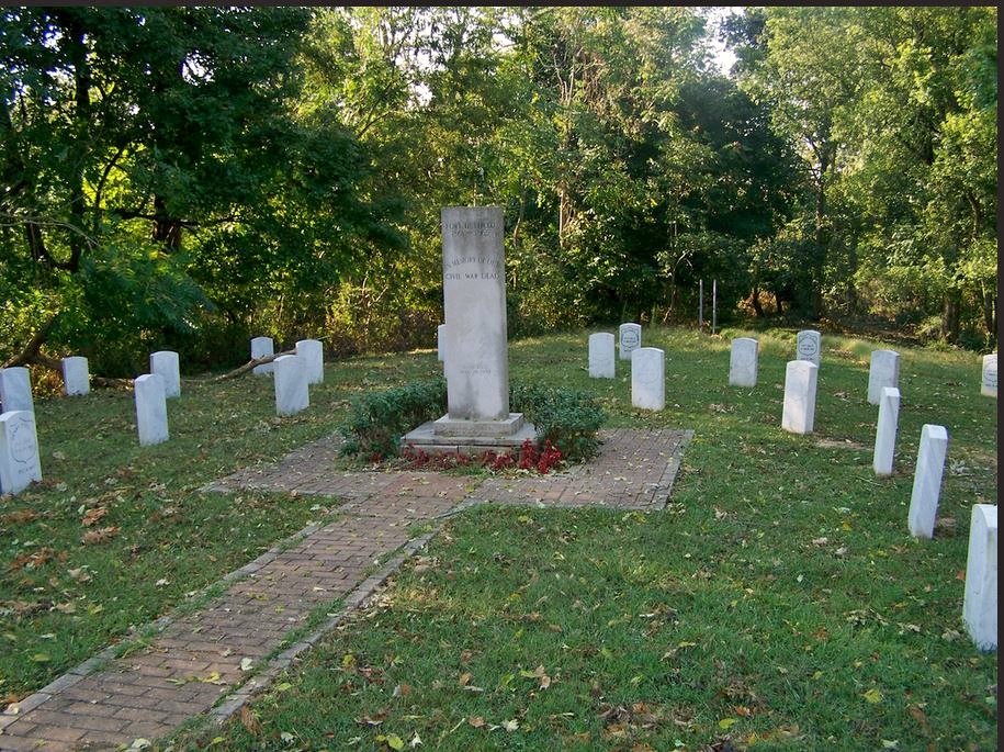
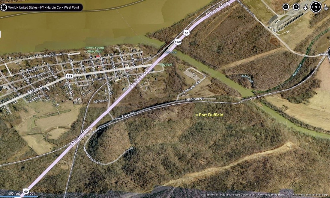
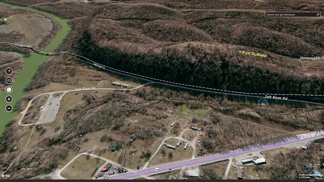
Fort Duffield
Fort Duffield was a Union American Civil War fort located
near the confluence of the Salt and Ohio Rivers outside West Point, Kentucky.
It saw use in 1862 and then was abandoned when it appeared that the war would
never come near the fort. Ironically, John Hunt Morgan in 1863 would lead his Raiders right past the fort and could have been stopped had the fort not been abandoned.
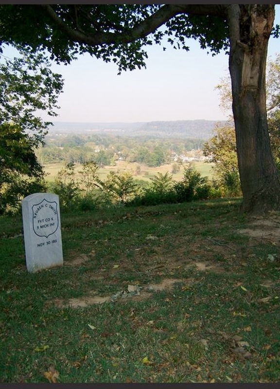
William Tecumseh Sherman was concerned with the Confederate positions in Bowling Green and Columbus, and sent the 37th Indiana and the 9th Michigan regiments to West Point. The plan was to use West Point as a Union supply base for Elizabethtown. Sherman ordered the fort to be built on Pearman Hill to protect the town and supply route. Construction began on November 3, 1861 and was finished in two months. The fort was named for the Rev. George Duffield of Detroit, whose son, Colonel William W. Duffield, led the 9th Michigan Infantry. There were 950 troops stationed at Fort Duffield, but they were soon sent to the front lines and the fort saw its last use in the fall of 1862.
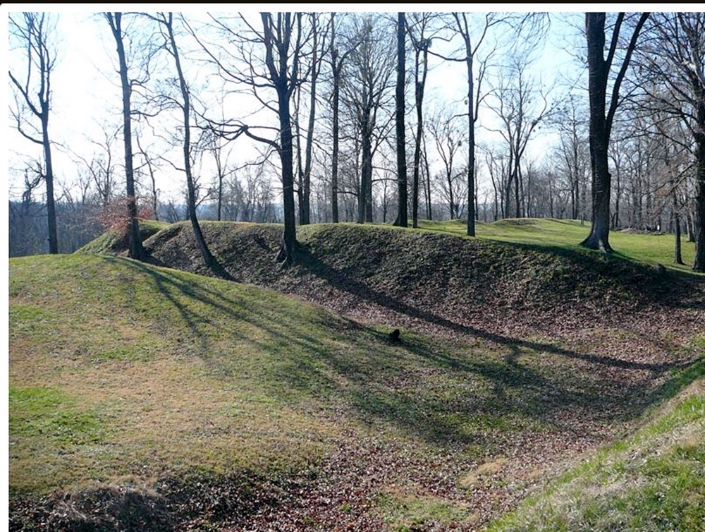
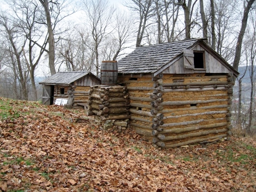
The fort is mostly a serpentine wall, unlike the typical star-shaped Civil War forts in Kentucky. The earthworks of the fort are well-preserved. Originally there was a one mile clearing between the fort and any trees, but since the fort's abandonment the forest has grown back around the fort. A fresh water spring was inside the fort. - Wikipedia
Fort Duffield was placed on the National Register of Historic Places in 1993
The entrance to Fort Duffield Park and Historic Site is located off U.S. 31W (Dixie Hwy) at Salt River Road, West Point, 7.5 miles south of the Gene Snyder Freeway.
http://fortduffield.com/
http://www.hardinkyhistory.org/fortduffield.pdf
William Tecumseh Sherman was concerned with the Confederate positions in Bowling Green and Columbus, and sent the 37th Indiana and the 9th Michigan regiments to West Point. The plan was to use West Point as a Union supply base for Elizabethtown. Sherman ordered the fort to be built on Pearman Hill to protect the town and supply route. Construction began on November 3, 1861 and was finished in two months. The fort was named for the Rev. George Duffield of Detroit, whose son, Colonel William W. Duffield, led the 9th Michigan Infantry. There were 950 troops stationed at Fort Duffield, but they were soon sent to the front lines and the fort saw its last use in the fall of 1862.
The fort is mostly a serpentine wall, unlike the typical star-shaped Civil War forts in Kentucky. The earthworks of the fort are well-preserved. Originally there was a one mile clearing between the fort and any trees, but since the fort's abandonment the forest has grown back around the fort. A fresh water spring was inside the fort. - Wikipedia
Fort Duffield was placed on the National Register of Historic Places in 1993
The entrance to Fort Duffield Park and Historic Site is located off U.S. 31W (Dixie Hwy) at Salt River Road, West Point, 7.5 miles south of the Gene Snyder Freeway.
http://fortduffield.com/
http://www.hardinkyhistory.org/fortduffield.pdf